AccuWeather meteorologists are closely monitoring Tropical Storm Pilar, which is currently drifting off the coast of El Salvador. There is a possibility of rapid intensification, similar to what we saw with Otis and Norma earlier this month.
During Saturday afternoon, a Tropical Depression, known as 19-E, developed in the eastern Pacific, a few hundred miles southwest of El Salvador. Benefiting from favorable conditions, the depression progressed into a tropical storm on Sunday evening.
According to AccuWeather Senior Meteorologist Adam Douty, the water temperatures in the region are well above the 80-degree threshold for tropical development. Additionally, there is very little wind shear affecting the system.
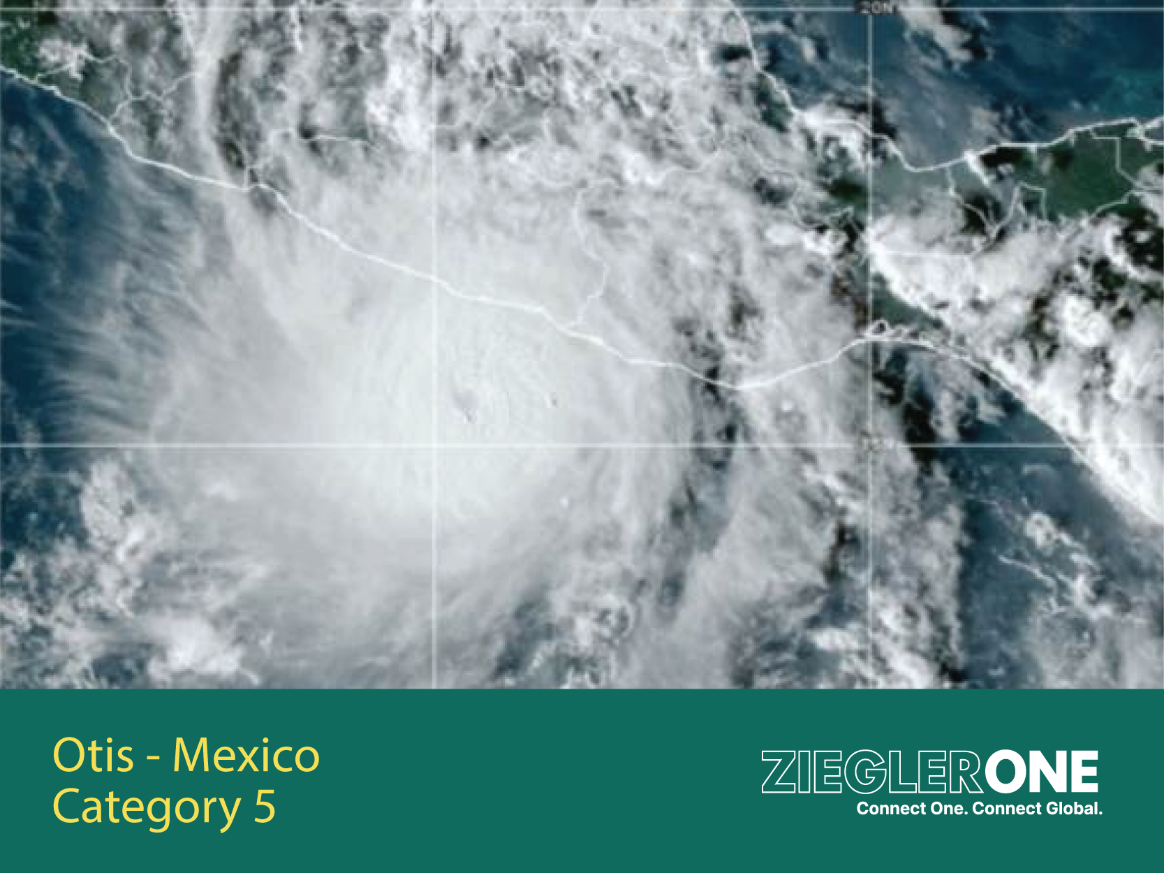
During rapid intensification, Otis transformed from a 70-mph tropical storm to a Category 5 hurricane in just 12 hours, with maximum sustained winds of 165 mph at landfall near Acapulco, causing tragic consequences. Otis is the only Category 5 hurricane on record to hit the Acapulco area.
The system had the potential over the week-end to intensify into a hurricane, with maximum sustained winds reaching 74 mph or higher.
According to Douty, Tropical Storm Pilar is expected to track further south along the coast compared to Otis. While this is positive news for Acapulco, where search, rescue, and recovery operations are already underway after Otis, Pilar could pose a significant threat to areas further south along the Pacific coast if it turns back towards the east or northeast.
Tropical Storm Pilar is projected to meander through the weekend, turning east next week before potentially making landfall anywhere from Nicaragua to southern Mexico. The system may not strike land due to light steering breezes.
There is a high likelihood of heavy rain, flash flooding, mudslides, damaging winds, and storm surge in the vicinity of where Tropical Storm Pilar makes landfall. The severity of these conditions will depend on the strength of Pilar as it approaches the coast and moves further inland. Additionally, coastal areas as far south as Nicaragua and as far north as the Mexico state of Chiapas may experience downpours and rough surf.
The current AccuWeather forecast for Tropical Storm Pilar calls for wind gusts of 40-60 mph (65-95 km/h) to impact much of El Salvador and the far southeastern coast of Guatemala, along with up to 4-8 inches (100-200 mm) of rain from Monday through Wednesday. The AccuWeather Local Storm Max™ for wind is 85 mph (135 km/h) and 16 inches (405 mm) for rain.
Tropical Storm Pilar is also being noted for how unusually far south it has formed. According to AccuWeather Senior Meteorologist Jake Sojda, if Pilar makes landfall in El Salvador, it would only be the second named storm on record to do so with the first and only so far being Selma in 2017.
AccuWeather meteorologists will continue to monitor the situation closely and will provide updates as it approaches land.
Original URL's:
https://www.accuweather.com/en/hurricane/tropical-storm-pilar-may-become-next-quick-strengthening-hurricane-in-wake-of-otis/1591406


 Ziegler One